
SWAIS2C
The Antarctic Science Platform is partnering internationally an exciting scientific drilling project, aiming to address the following questions:
- How will marine-based ice sheets respond to a 2°C increase in global temperature?
- Under what climatic conditions does the West Antarctic Ice Sheet (WAIS) collapse?
- What are the local, regional, and global environmental consequences of melting ice sheets?
Evidence from the Earth’s past is needed to determine the future.
Melting ice – rising sea
The Paris Agreement presents an ambitious goal: to keep global warming less than 2°C above pre-industrial levels. But these targets present a massive challenge, as global average temperature is already 1°C above pre-industrial levels and rising.
Due to polar ice melt, global average sea level will rise, but not uniformly across the planet. Local and regional sea level change depends on where ice and water are distributed around the Earth’s surface, and how this changes as the polar ice melts and is added to the ocean.
We know sea level will rise at least 30cm over the next several decades, potentially displacing many millions of people living in low lying coastal areas. If Antarctica’s ice shelves and the West Antarctic Ice Sheet collapse, global sea level will rise up to five metres. We need to understand the environmental conditions that will cause WAIS to collapse, when it will happen and just how fast it can retreat.

The West Antarctic Ice Sheet
The West Antarctic Ice Sheet (WAIS) is presently losing mass at an accelerating rate, but the response of the WAIS to a projected 2°C (or more) global warming remains a significant uncertainty in sea level rise projections. WAIS is inherently more susceptible to collapse than the East Antarctic Ice Sheet as it sits on land well below sea level and its margin is exposed to a warming ocean. Of particular concern is that the submarine land surface on which the WAIS sits deepens from the ice sheet margin towards its centre and has potential for runaway and unstoppable retreat, if the large fringing ice shelves that help to hold it in place collapse, ice flow increases, and gravity ‘takes over’.
Our research aims to understand the timing of past Ross Ice Shelf collapse and WAIS retreat, and the local and regional environmental conditions that drove these changes during past warmer-than-present climatic conditions.
During the last interglacial period (125,000 to 120,000 years ago), global temperatures were 1°C - 1.5°C warmer than pre-industrial times, similar to those that now appear to be unavoidable, and we will see in the coming decades even as we strive to reduce atmospheric carbon emissions. Due to ice melt, sea level was as much as six metres higher than present day. This extra freshwater in the ocean came from Earth’s large ice sheets but it’s not yet clear how much came from Greenland and how much from Antarctica.
We aim to answer the key question: Did the West Antarctic Ice Sheet melt during previous warm interglacial periods?
To do this, we will collect geological records from the centre of West Antarctica.

Drilling approach for the SWAIS2C initiative.
Scientific drilling into Antarctica’s sea floor
West Antarctica is largely ice-covered, which means its geological archives are hidden. Scientific drilling is vital to access valuable archives of past climate and ice sheet behaviour.
This ambitious drilling and research programme with international collaborators aims to obtain the sedimentary history at two locations (Kamb Ice Stream and Crary Ice Rise) near the modern grounding zone of the West Antarctic Ice Sheet. In this location, along the Siple Coast in the West Antarctic interior, the West Antarctic Ice Sheet first lifts off from the sea floor and begins to float.
Our team of engineers has developed a new ice and sediment drilling system. They first melt a hole through floating ice with a hot water drill. Then the purpose-built light-weight sediment coring system will drill over a hundred meters into the sea floor. This transportable system is capable of recovering ~200 metres of sediment from beneath the sea floor in places where the combined depth of the ice shelf (or sea ice) and water column is over 1000 metres thick.

Map supplied by Antarctica NZ Sourced from Quantarctica and the Norwegian Polar Institute Retrieved 12 January 2024 2
Analysis and modelling
Drilling at the Kamb Ice Stream site began 2023. The team will return there in 2024, followed by drilling at another site at the Crary Ice Rise site in 2025.
A larger team of international scientists will study the sediments and reveal environmental secrets currently hidden beneath the ice. The new records will be used to reconstruct past climate conditions and will tell us how the West Antarctic Ice Sheet behaved in the past. We can then test the climate and ice sheet models that we use to project, understand and foresee our possible future.
This new information will allow us to take a huge step forward as we strive to learn just how sensitive West Antarctica is to a warmer climate. We will find out whether our efforts to reduce greenhouse gas emissions can save the Ross Ice Shelf and West Antarctic Ice Sheet and limit global sea level rise.

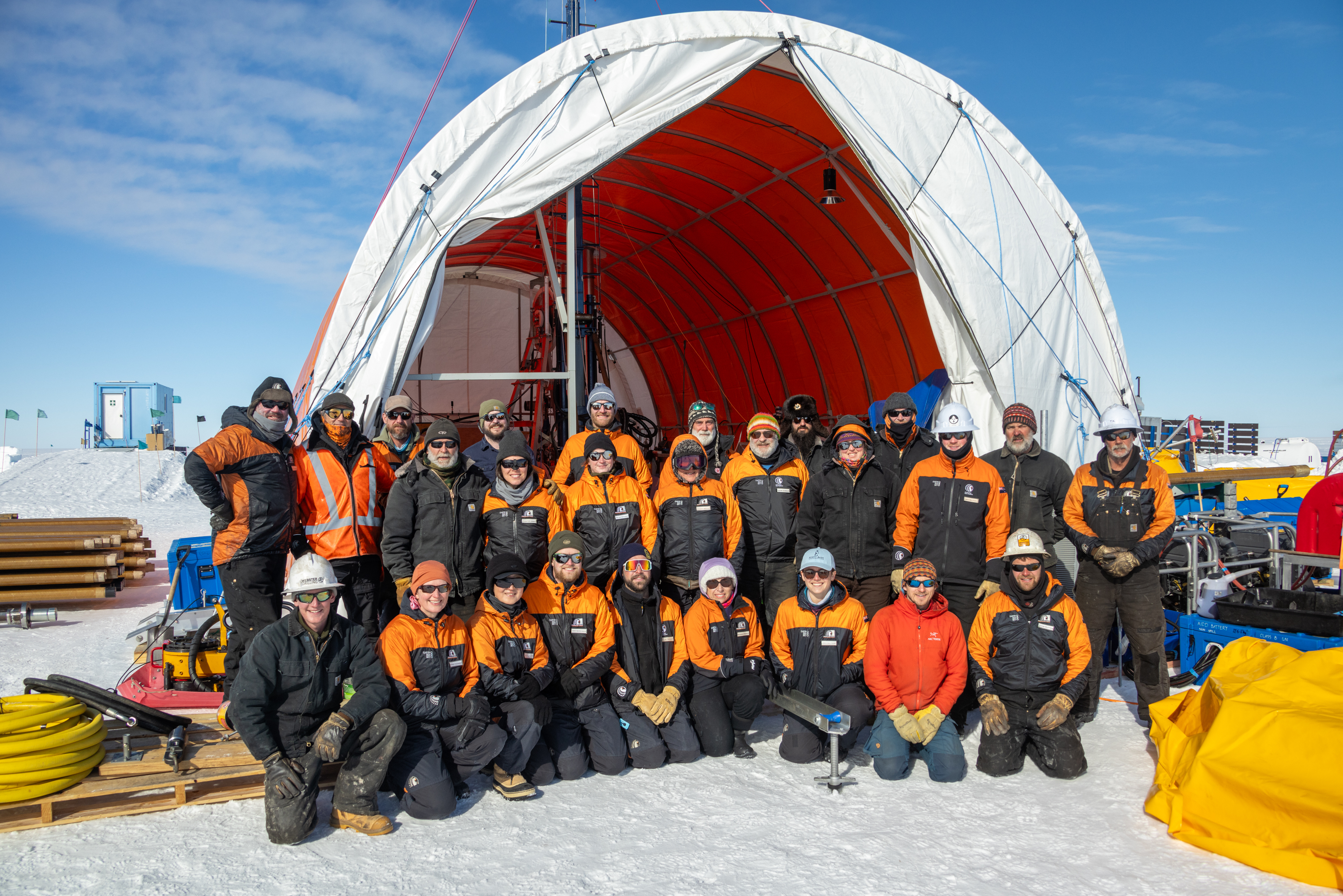
Coring team. Photo: Anthony Powell

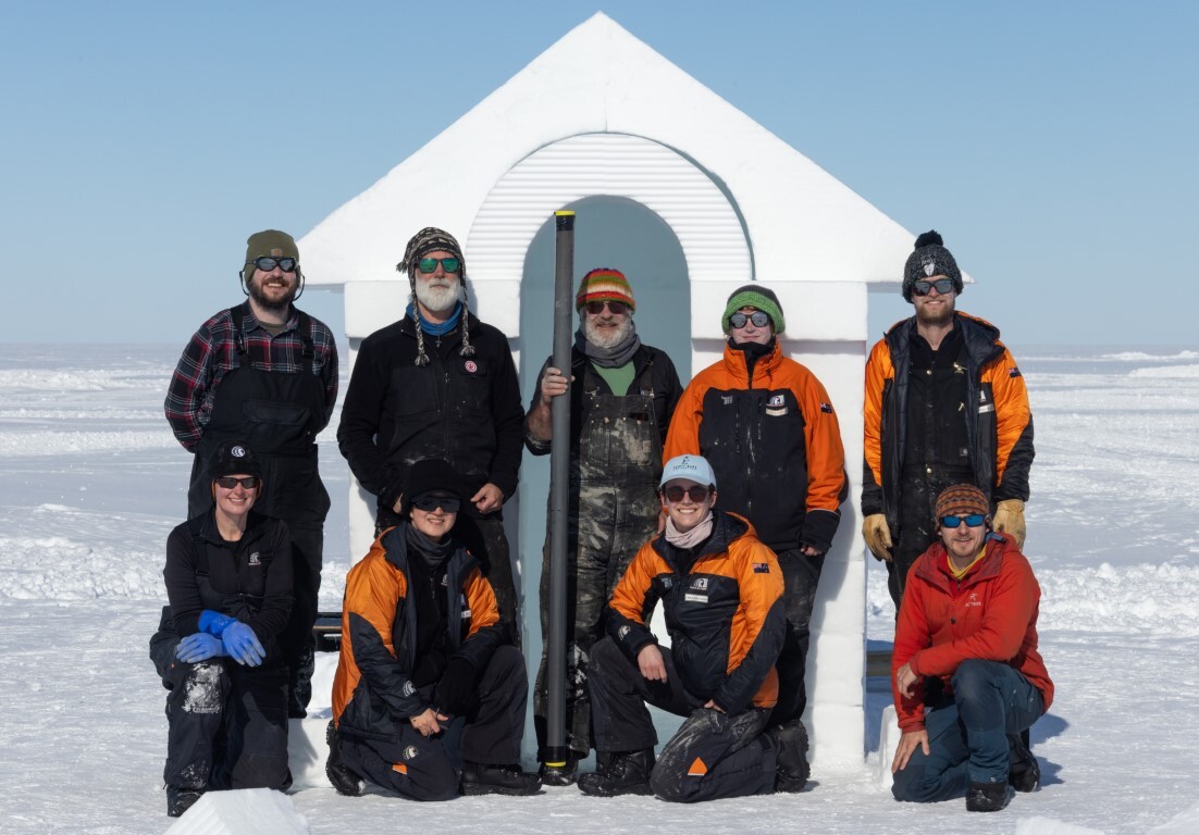
The core is scored with a saw before manual splitting. Linda Balfoort/Victoria University of Wellington
Scientific objectives
Hypothesis 1: Ice-solid-Earth feedbacks influenced ice-dynamics along the Siple Coast on a multi-millennial timescale trajectory during the Holocene (11,700 years ago).
Aim: Understand grounding line dynamics along the Siple Coast margin of WAIS between the last glacial maximum and recent time.
Hypothesis 2: Ocean temperatures and circulation patterns are the key governing factor in driving WAIS dynamics during warmer than present Late Quaternary (past ~2 million years) super-interglacials.
Aim: Determine the Late Quaternary ice sheet contribution to sea level in response to past temperature that were similar to those anticipated under near-future climates.
Hypothesis 3: Marine-based ice sheets did not advance across the continental shelf during the early Pliocene (5.3 – 2.6 million years ago).
Aim: determine the extent of glacial retreat and marine incursion into West Antarctica during the Pliocene (the last time atmospheric CO2 levels exceeded 400 ppm and global mean temperatures were a few degrees warmer than pre-industrial).
Hypothesis 4: A smaller than present terrestrial AIS during the Miocene Climate Optimum (15 to 17 million years ago) produced by a combination of high atmospheric CO2 and tectonic land subsidence resulted in extensive highly productive shallow marine seas, that subsequently drew down CO2 and culminated in global cooling and ice expansion during the middle Miocene Climate Transition (15 to 13 million years ago).
Aim: understand Late Oligocene to Miocene variability and the role of tectonics and carbon cycle feedbacks.
Hypothesis 5: Determining the taxonomy and activity of both living and inactive microbial populations in sediments will provide insights to modern element cycling and past environmental conditions.
Aim: explore microbial communities living beneath the surface in past extreme polar environments.
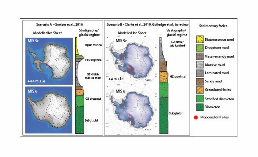
Two contrasting published ice sheet model simulations for the penultimate glaciation (MIS 6) and LIG (MIS5e) and the resulting sedimentary sequences that would accumulate at the KIS and CIR sites for (Scenario A) complete Ross Ice Shelf collapse in MIS5e and (Scenario B) a stable RIS in MIS5e. Drilling will identify which sequence (and ice sheet configuration) is most accurate.
Research and funding partners
- Antarctica New Zealand
- Antarctic Science Platform
- Australian and New Zealand IODP Consortium
- Au Scope
- AWI
- Federal Institute for Geosciences and Natural Resources
- Earth Sciences New Zealand (formerly GNS Science)
- International Continental Scientific Drilling Program
- Korea Polar Research Institute
- National Institute of Geophysics and Volcanology
- National Institute of Polar Research
- National Science Foundation
- National Environment Research Council
- Te Herenga Waka—Victoria University
- SWAIS 2C


