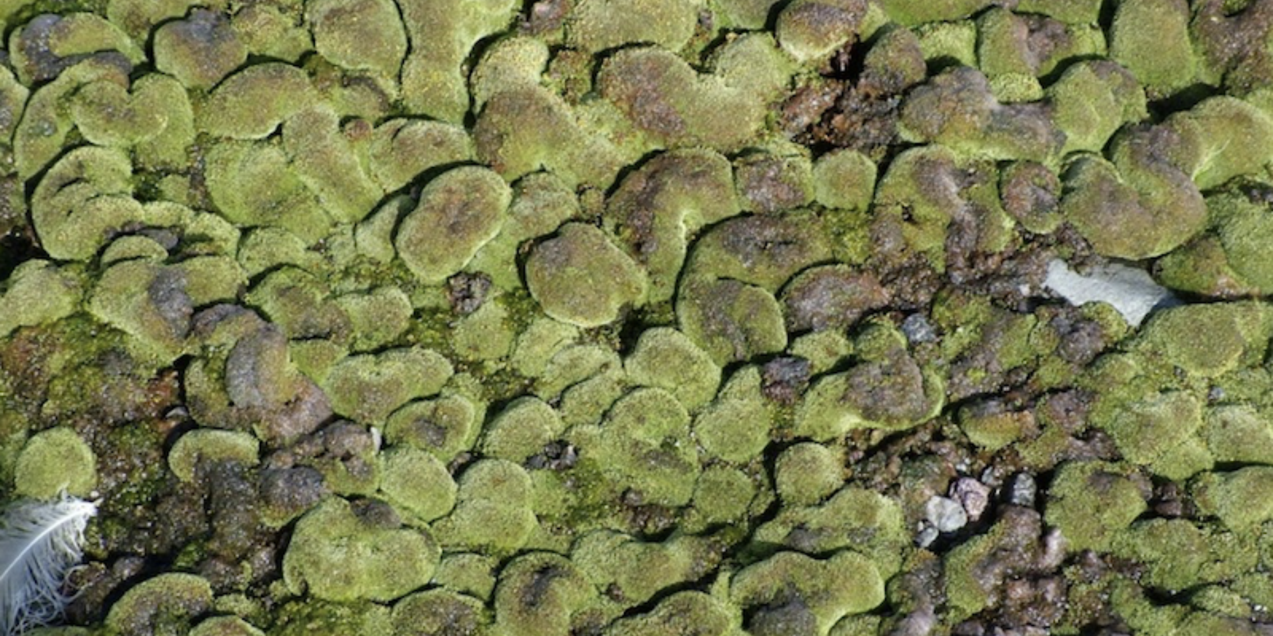
Figure 1: Moss at Cape Hallett. Photo: Catherine Beard
Case Study: New baseline distribution model—a tool to predict responses of foundational terrestrial organisms to climate change
Mosses are widely distributed habitat-building species in ice-free regions of Antarctica. They play the role of forests in warmer places. A new distribution model predicts where mosses may be found and where they may be most vulnerable to changing conditions. This tool can enable management plans to be adapted to optimise ecological outcomes.
Terrestrial Ecosystems
Changing environmental drivers are expected to affect the distribution of organisms across Antarctica. Future conditions might allow species already in Antarctica, or new to the continent, to extend into areas previously untenable for them. This movement could displace other species, risking irreversible disruption of the existing species distribution patterns. But our understanding of Antarctic terrestrial biodiversity is incomplete, and efforts to plan for biodiversity conservation are hampered by a scarcity of biogeographic data on where foundation species (those that define and structure communities) are currently located.
Vegetation is an example of a foundational biological resource in Antarctica restricted to the few ice-free areas. Among the existing terrestrial vegetation, mosses are locally dominant, capable of forming dense stands of vegetation despite harsh environmental conditions. While most known moss diversity occurs on the warmer and wetter Antarctic Peninsula (south of South America), the Ross Sea region (south of New Zealand) hosts important moss habitats supporting notable diversity and biomass. Hotspots include Botany Bay and Cape Hallett. A broad spatial distribution, along with an expectation of rapid response to environmental changes, makes mosses a useful candidate to be sentinels of climate change. However, our understanding of the true distribution of these plants is constrained by the scarcity of available data, with high-quality surveys limited to a few locations across the continent.
Closing the data gap
Platform-funded PhD student Gabrielle (Gabi) Koerich used species distribution modelling to map potential moss distribution across the continent. This is a statistical approach that used the environmental characteristics of locations where moss species are known to be present (accounting for historical sampling bias), to derive baseline models of the likely distribution of 28 moss species across the Antarctic continent, with special focus on the Ross Sea region (Figure 2).
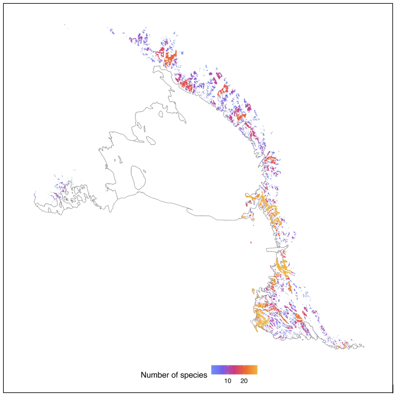
Figure 2: Model predictions of the number of moss taxa that could be supported across the Ross Sea region under current climate conditions.
Learnings from the moss distribution model can support the development of management tools
A guide for moss habitat sampling
The model-derived predictions of suitable moss habitats reveal that this region contains areas with significant suitability for many individual moss species, including species not currently known for the Ross Sea region. While the model’s predictions overestimate moss presence in the Ross Sea region, since other environmental factors not included in model derivation may limit moss occurrence in specific locations, it does provide a robust indicator of areas where species can potentially exist.
This tool can be used to target areas to be sampled to better understand whether discrepancies between current knowledge of moss distributions and model predictions stem from insufficient sampling or from other unknown ecological factors that need to be added to iteratively improve the model. One such example is the Platform’s recent collaboration with the Australian SAEF (Securing Antarctica’s Environmental Future) programme to support a biodiversity-based expedition to the remote Morozumi Range, where the model predicts >15 moss species. Despite extensive searching, no mosses were observed, with the challenges of colonisation by mosses of the isolated region being the suspected explanation.
A baseline for projections
Understanding how environmental factors relate to moss presence helps in comprehending how changing environmental conditions may affect these species. The baseline model can be used to project likely changes, by applying climate projections to the environmental data that drives the distribution model.
Interconnected ecosystems
The models also demonstrate an important association between seabird colonies and moss presence, likely due to the guano providing essential nutrients and/or the birds moving the mosses around. This highlights important connections between terrestrial and marine ecosystems.
Moss as an indicator of meltwater availability
Glacial melt, which affects soil moisture, is a critical link between climate change and the terrestrial ecosystem response. Water availability emerged as a key limiting factor for mosses, confirming the importance of this environmental driver for Antarctic terrestrial communities. In this way, Antarctic vegetation can be used as a proxy for meltwater presence (because vegetation type reflects long-term moisture availability). Often, variations in meltwater flow and quantity are too subtle and ephemeral to be detected using instrumentation.
Informing management interventions
The importance of establishing this baseline distribution lies in anticipating which environmental conditions, if altered, will most significantly impact moss distributions in the Ross Sea region. Such projections can be used to identify particularly vulnerable locations, where management intervention such as increased protection from activities that promote species transfer, needs to be enacted. By predicting where changes are most likely and consequential, we can mitigate risk of degradation of Antarctic biodiversity due to changing climate and environmental conditions.
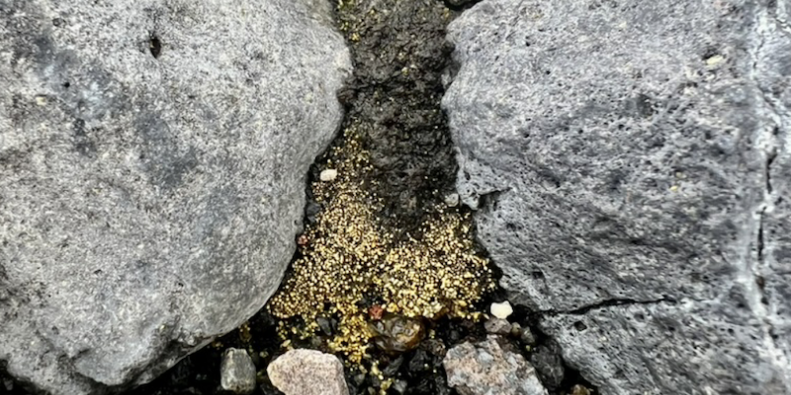
Figure 3: Mosses in the Ross Sea region's Dry Valleys can be quite small and hard to detect. Photo: Gabrielle Koerich.
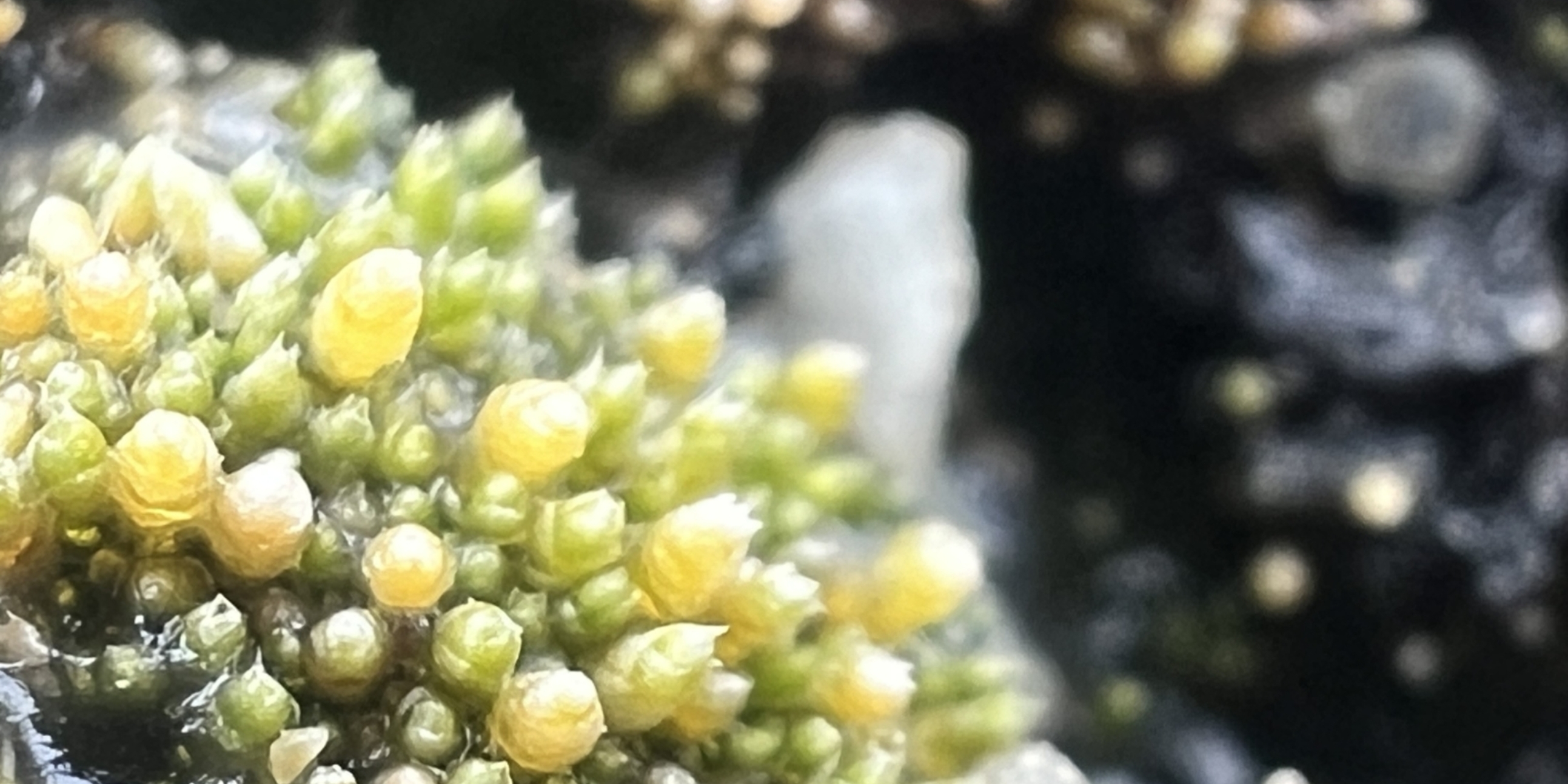
Figure 4: Actively growing moss in the Ross Sea region. Photo: Gabrielle Koerich
References:
G. Koerich, H. Lai, C. Lee, F. Morgan, J. Tonkin. 2025. Proximity to seabird colonies and water availability shape moss distributions in Antarctica. Authorea. doi: 10.22541/au.174619682.29633923/v1
Green, T. A., Seppelt, R. D., Brabyn, L. R., Beard, C., Türk, R., & Lange, O. L. (2015). Flora and vegetation of Cape Hallett and vicinity, northern Victoria Land, Antarctica. Polar Biology, 38, 1825-1845.
This case study was prepared as part of the Platform’s annual reporting to the Ministry of Business, Innovation and Employment for the 2024/25 contract year. It describes the development of a new tool for monitoring change in environmental conditions and terrestrial habitats in Antarctica.